Trout Valley Roads
2023 Roads Project Update:
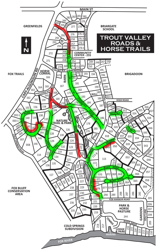
Beginning in October, the 2023 Roads project will include repairs for the following roads:
Beginning in October, the 2023 Roads project will include repairs for the following roads:
- Stonegate Road - From the entrance to the end of the old road
- Road markers have been put out showing the width of the road at the narrow points along the old police station
- Rainbow - From Turkey Hill to Trout Valley Road
- Turkey Hill - From Hawthorne to Big Oaks
- Trout Valley Road - From the last project completion to Brookbridge
- Storm Water Pipe repairs under Trout Valley Road will begin Thursday 10/5
- Shoulder Improvements will be included where we are experiencing washout:
- Big Oaks Road Cul-de-sac & along north part of road
- Marryat Road along recently replaced road section
- River Drive along Tom Sawyer Pond
- River Drive at the turn leading into the lower pasture
Background
Historically, Trout Valley roads have been resurfaced using a method that removed a small top layer of the asphalt and replaced that small top layer. This usually meant that the roads deteriorated fairly quickly and required re-paving every 10-12 years. Beginning in 2016 the Association began the process of full depth reclamation on the Trout Valley Roads. This process provides a more stable base for the roads, allowing them to last for 25+ years before needing any resurfacing.
Trout Valley has roughly 5.7 miles of roads, all of which are in varied state of disrepair and will require attention in the coming years. Approximately 2 miles have undergone the full depth reclamation process, and the remaining roads will cost roughly $1.25M to complete.
In the table below you can see each road, or road section, and the details we have about the road.
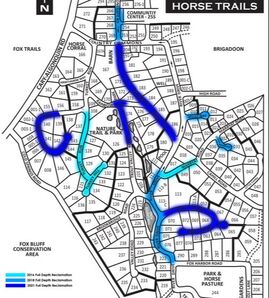
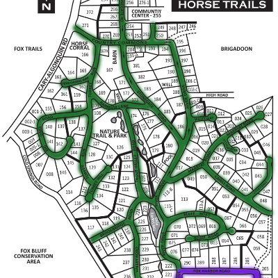
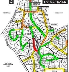
The maps below show more details about the Trout Valley Roads:
As road projects are planned this page will be used to communicate those project plans.
Trout Valley has roughly 5.7 miles of roads, all of which are in varied state of disrepair and will require attention in the coming years. Approximately 2 miles have undergone the full depth reclamation process, and the remaining roads will cost roughly $1.25M to complete.
In the table below you can see each road, or road section, and the details we have about the road.
The maps below show more details about the Trout Valley Roads:
- The first map shows which roads have undergone full depth reclamation.
- The second map shows which roads are owned by the Trout Valley Association, and which roads are owned by the Village of Trout Valley.
- The third map shows the current grade of each road based on the road condition.
As road projects are planned this page will be used to communicate those project plans.